About EasyCockpit
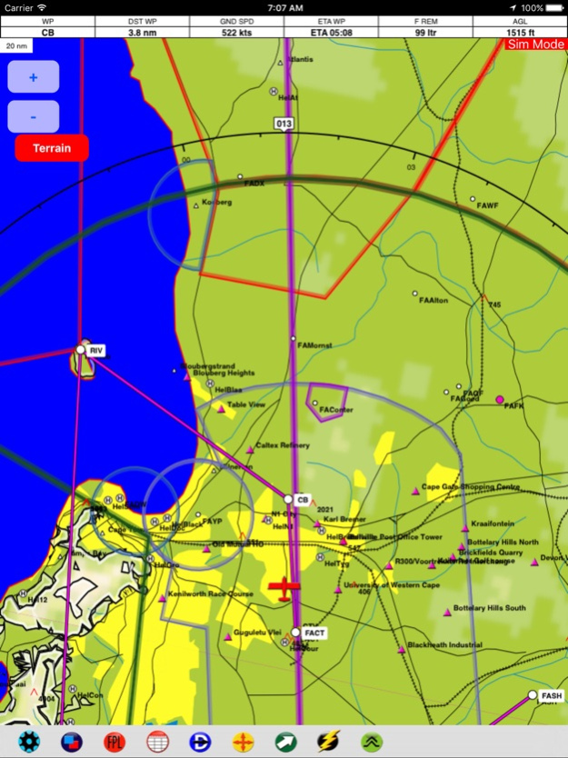
EasyCockpit is a comprehensive aviation navigation tool for mobile devices and has for many years aided pilots by improving their situational awareness when flying in Southern Africa. This GPS moving map software with...
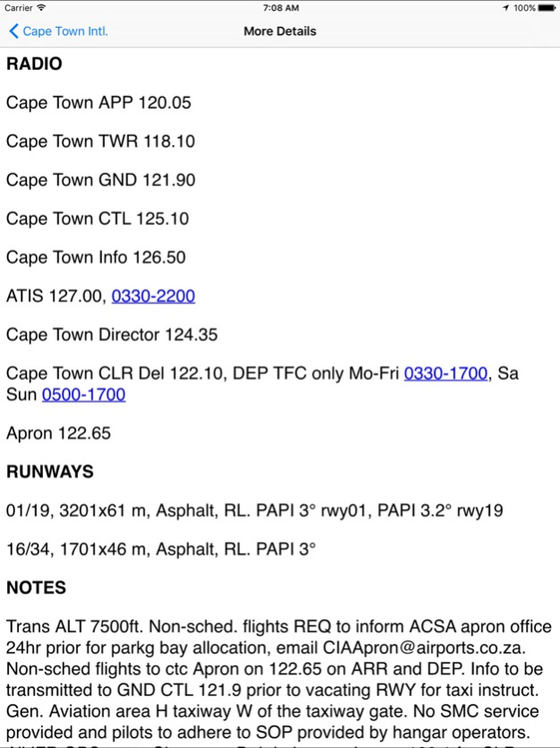
EasyCockpit is a comprehensive aviation navigation tool for mobile devices and has for many years aided pilots by improving their situational awareness when flying in Southern Africa. This GPS moving map software with detailed information will make your flying experience in this part of the African continent a safer one. The high-resolution clear vector map is offering an extensive airfields database including communication and navigation frequencies, runway information, fuel availability, cautionary notes, and sunrise/sunset times. Full airspace information, including special VFR routings and reporting points around congested areas, makes this GPS moving map a must for pilots flying in Southern Africa. Visit our website for details on how to obtain the full version.
Comprehensive Mapping data
Coverage: South Africa, Botswana, Lesotho, Malawi, Namibia, Swaziland, Angola, Mozambique, Zambia, Zimbabwe
Flight Planning by selecting waypoints/ abeam waypoints from database or map. Option to insert Airspace Intersection. Option to upload routes from EasyPlan.
Layers can be switched on or off.
Terrain display
FlightLog displays distance to next waypoint, ground speed, desired track, ETE and ETA. Also displays current position in relation to recognized VFR points for accurate reporting.
Direct-To function shows the 10 nearest airfields and 10 nearest navaids or other points.
Move-To button lets you quickly find a point from the database to check details and view it on the map.
HSI needle determines the distance off Track.
The RMI needles allow you to choose one or two points to which the needles will point to provide a bearing.
The OBI radial or Track-To can be selected to be displayed from any waypoint, navaid or airfield.
E6B calculator allows for accurate and speedy calculation of density altitude, true airspeed, windspeed and direction.
Airspace, obstacle and Terrain warnings.
Fly in Track-Up or North-Up mode.
Continued use of GPS running in the background can dramatically decrease battery life.
Apr 1, 2024
Version 1.76
NavData April 2024 Update
Previous Versions
Here you can find the changelog of EasyCockpit since it was posted on our website on 2023-09-07 08:49:15.
The latest version is 1.76 and it was updated on 2024-04-22 19:44:55. See below the changes in each version.
EasyCockpit version 1.76
Updated At: 2024-04-01
Changes: Apr 1, 2024
Version 1.76
NavData April 2024 Update
EasyCockpit version 1.75
Updated At: 2024-02-22
Changes: Feb 22, 2024
Version 1.75
- NavData Update Feb
- Updated roads and dams in topographical data
- Improved ground shading
EasyCockpit version 1.73
Updated At: 2023-12-01
Changes: Dec 1, 2023
Version 1.73
NavData Dec 2023 Update
EasyCockpit version 1.72
Updated At: 2023-10-13
Changes: Oct 13, 2023
Version 1.72
NavData Update Oct 2023
Ability to email/delete multiple flight plans
Save flight plan as option
EasyCockpit version 1.71
Updated At: 2023-07-31
Changes: Jul 31, 2023
Version 1.71
- NavData Aug 2023 Update
- Updated onboard fuel management
- Email single or all flight plans
- Fix for iPad Mini 6 gen screen size
Disclaimer
Official App Store Link
We do not host EasyCockpit on our servers. We did not scan it for viruses, adware, spyware or other type of malware. This app is hosted by Apple and passed their terms and conditions to be listed there. We recommend caution when installing it.
The App Store link for EasyCockpit is provided to you by apps112.com without any warranties, representations or guarantees of any kind, so access it at your own risk.
If you have questions regarding this particular app contact the publisher directly. For questions about the functionalities of apps112.com contact us.